Hilário de Sousa
Jump to:
- Pacific script flowchart
- Te pūao o PEARA
- Oceania: Population in Hexagons
- We need more Chinese LanguageS Weeks
- Auckland Public Transport 2028
- US, Canada etc.: Population in Hexagons
- U-turn at traffic lights in CA AU NZ
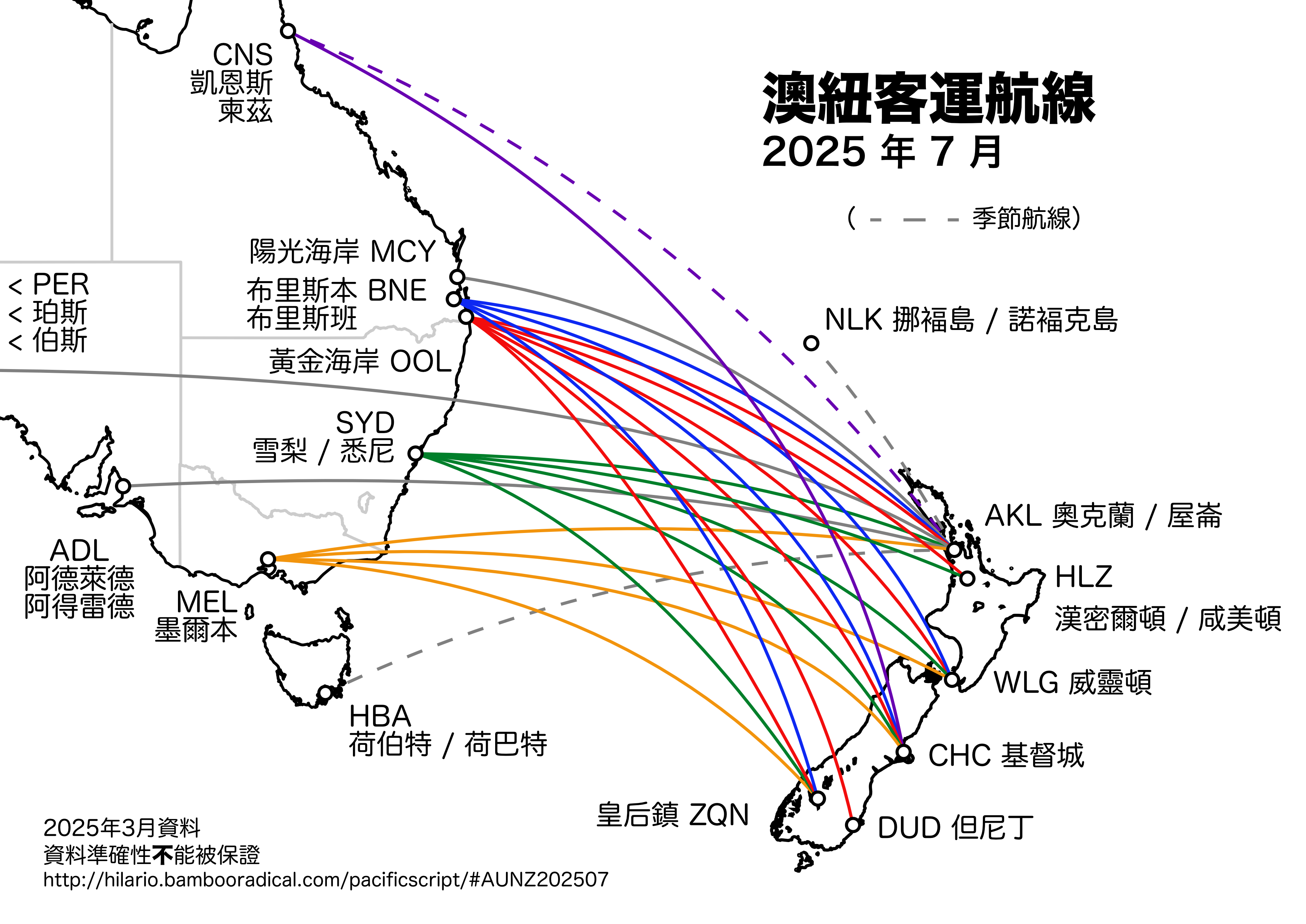
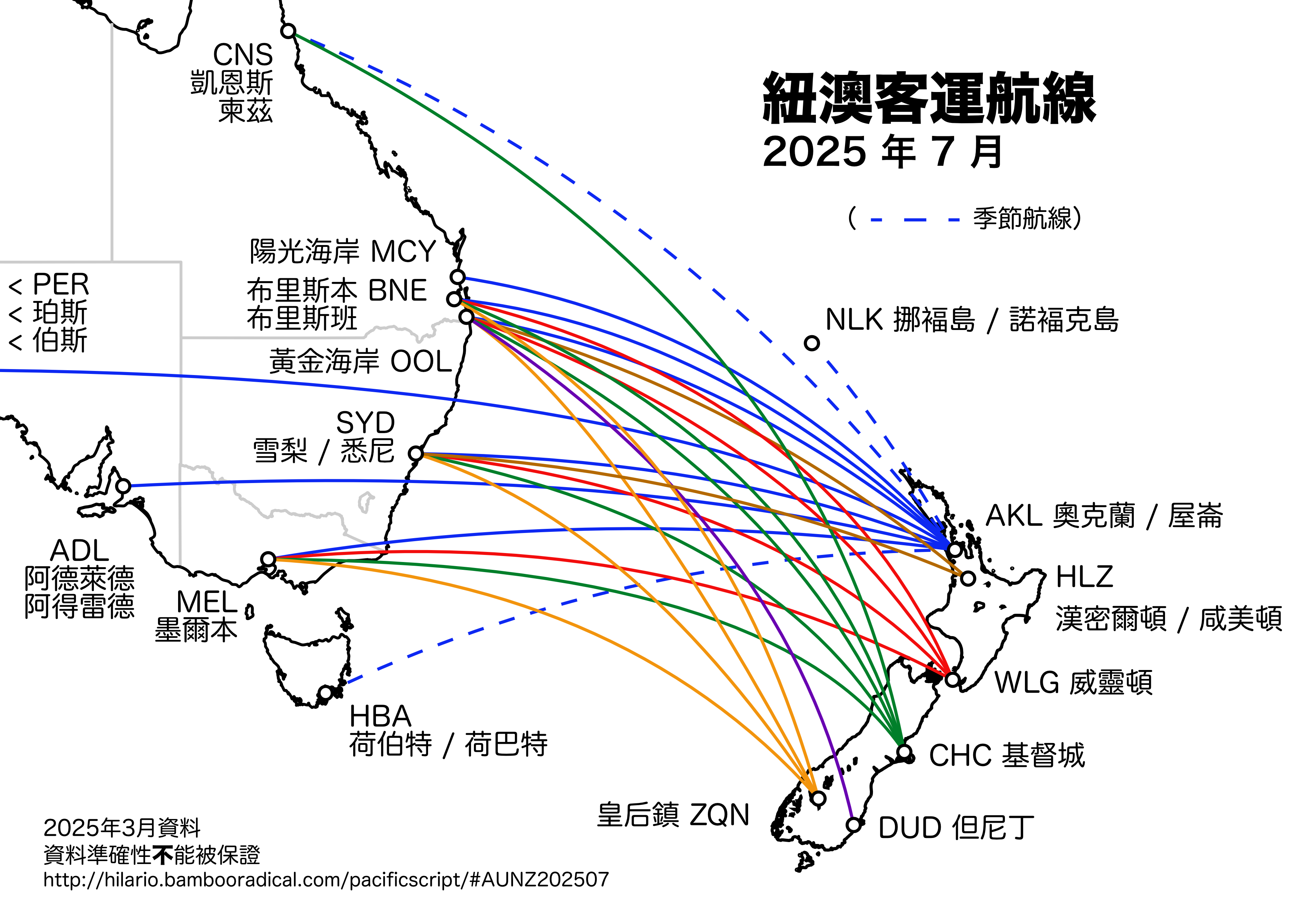
- 2025 年 7 月澳紐客運航線
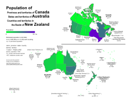
- Population of Canada, Australia, and New Zealand in Q3 2024
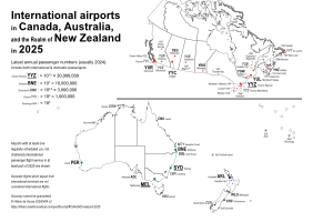
- International airports of Canada, Australia, and New Zealand in 2025
Pacific script flowchart
The following is a flowchart for identifying the major scripts of indigenous spoken languages in Micronesia, Fiji, and Polynesia (pdf 165KB).
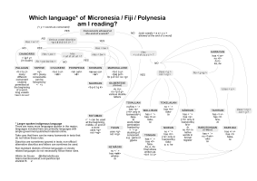
Here is a little quiz for identifying these 23 languages!
Some governmental websites with material in various languages from Micronesia / Fiji / Polynesia (notice that these texts do not necessarily follow the "official" spelling rules fully):
- Pacific Language Weeks – New Zealand
- United against COVID-19 – New Zealand
- Department of Health – Australian government
- YouTube Channel of le Gouvernement de la Nouvelle-Calédonie
- COVID-19 – State of Hawai'i Portal
- Novel Coronavirus COVID-19 – Multnomah County
- Centers for Disease Control and Prevention – United States of America
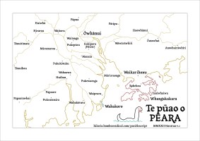
Te pūao o PEARA
Just for fun: Map of the mouth of the Pearl River in te reo Māori. The translations from Chinese are not totally accurate; some considerations are given towards Māori naming norms.
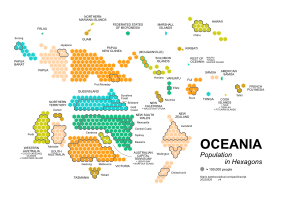
Oceania: Population in Hexagons
(A new version is coming out in June 2024!)
The following is a schematic representation of the population in Oceania. This is the data and some explanations.
This is inspired by the ABC 2022 federal election map. My map is based on population in general, whereas the ABC map shows electorates, which is based on voter population. (The number of voters per electorate is significatly lower in Northern Territory and Tasmania. See, e.g., this.)
We need more Chinese languageS Weeks
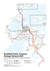
Auckland Public Transport 2028
Schematic map of the public transport Strategic network proposed by Auckland Transport in its Regional Public Transport Plan 2023–2031 (pdf), approved in late November 2023. (pdf; older version: pdf, png)
Canada etc.: Population in Hexagons
(This has been superseded by the following. Old pdf, old data tables.)
USA: Population in Hexagons
(This has been superseded by the following. Old pdf (v6), pdf (v4), old data tables.
I would like to thank the many comments that I received here, here, here, and here. The long list of suggestions from u/nine_of_swords was particularly helpful.)
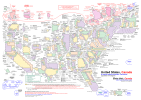
US, Canada etc.: Population in Hexagons
The following is a schematic representation of the population in United States, Canada, and nearby small countries and territories (pdf, png). Data tables. Electronic maps of US census 2020, Canada census 2021. PDF maps of Canadian census units. Statistics Canada's definition of "Northern Canada": list, map.
See also the Oceania diagram above.
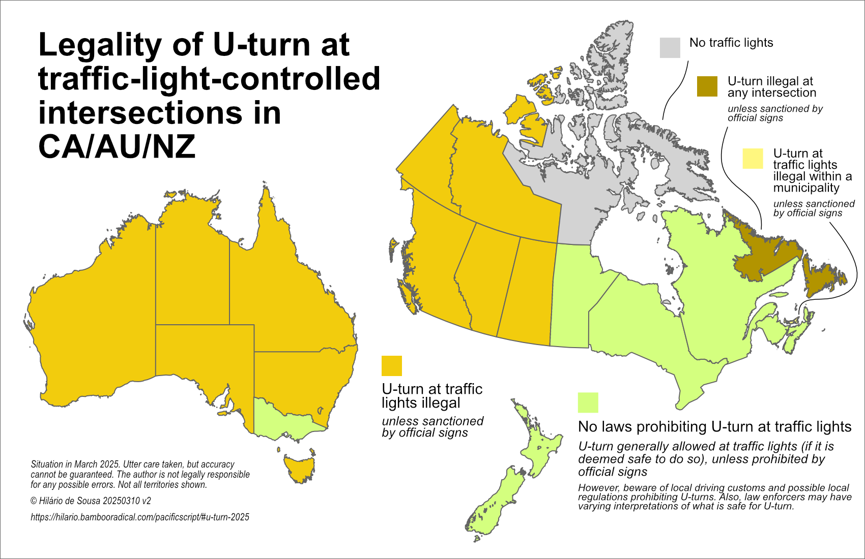
U-turn at traffic lights in CA AU NZ
This diagram outlines whether it is legal to do a u-turn at a traffic-light-controlled intersection or not in Canada, Australia, and New Zealand in March 2025.
2025年7月澳紐客運航線
Population of Canada, Australia, and New Zealand in Q3 2024
International airports of Canada, Australia, and New Zealand in 2025